Foxboro, MA
Here’s a map of F. Gilbert Hills State Forest. I’ve marked NativeAmerican stone structures, many of which I found with the help of this site, which was created by Chuck Drayton.
Click here for info about F. Gilbert Hills, and a map. I suggest you ignore my route, and follow the map below (my 2nd map of F. Gilbert Hills), or the “official map,” or the AllTrails map. The AllTrails map is especially useful; it not only shows the main trails, it also shows little dead-ends that lead to interesting boulders. F. Gilbert Hills is a large preserve, probably more than 1,200 acres, if you count the adjacent town parks.
F. Gilbert Hills has some of the best “balancing boulders” (sometimes called “perched rocks”) you’ll find anywhere. Like Lincoln Woods, F. Gilbert Hills is naturally rich in erratic boulders.
Some of the main trails are former roads, hence they’re wide. In some places, the soil has washed away, leaving only stones behind, and making the trail rough. In other places, grass has grown up, creating a tick danger.
There are some charming waterholes (dug for horses? or for fire-fighting?), numbered 1 through 17 on the official map. There are also streams and ponds. When I was there, beavers had dammed a stream, and flooded some trails.
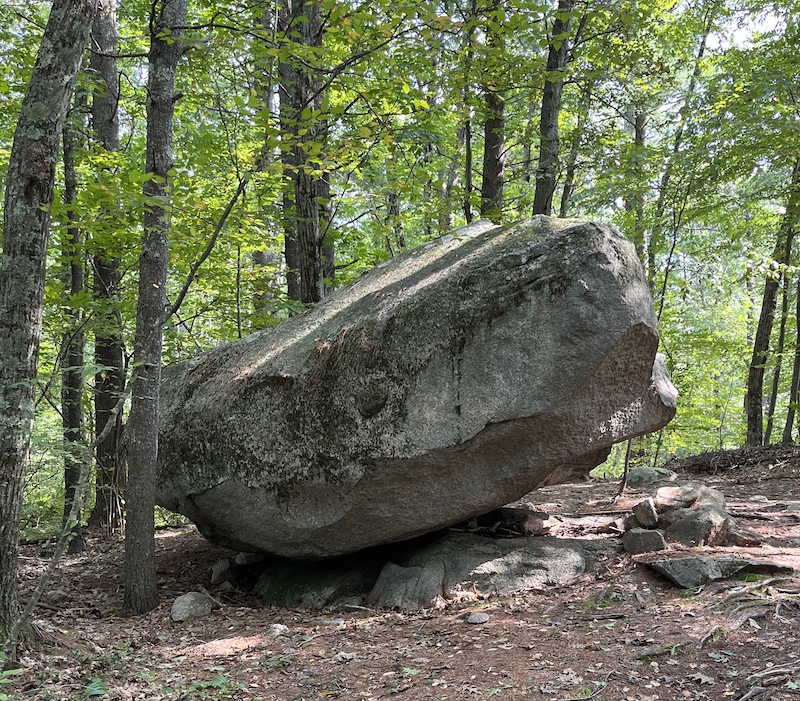
One of the highlights of Gilbert Hills is the “Foxboro Dolmen” — a large, flat rock resting on 3-4 smaller rocks, creating a low table or seat. I don’t think the builders of the Dolmen thought of it as a table or seat — I’m not sure how they thought of it — but weary hikers nowadays probably use it as a table or seat. I’ve marked the location of the Dolmen with a D; it’s near a major trail (the Dolmen is on Megley Trail, about 1/4 mile south of High Rock Road).
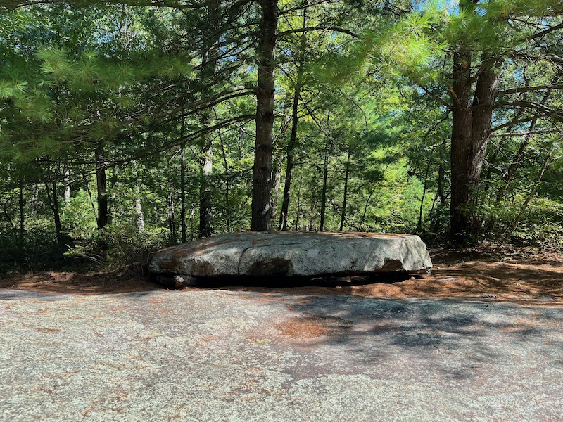
Foxboro Dolmen
Near the Dolmen is a row of boulders, doubtless set up by Native Americans. A website says that there are four boulders, the boulders are 100 feet southeast of the Dolmen, the boulders are aligned North-South, and they’re 22 feet apart.
The website also says that the Dolmen has a groove or crack that points to the Boulder Row; this groove may have been chiseled by Native Americans. The groove may have been for collecting blood from an animal being butchered on the Dolmen (any liquid will flow through the groove to the bottom of the Dolmen).
Some of the boulders in the row have been perched or balanced on smaller rocks. I marked the location of the row with an R.
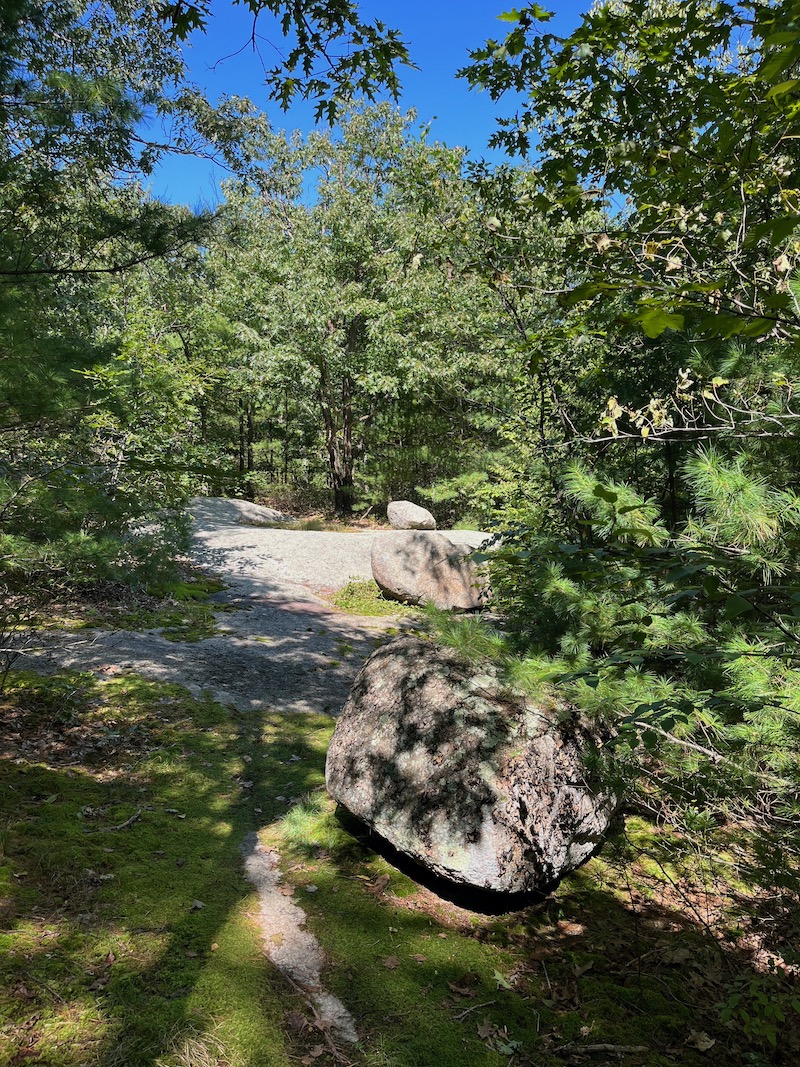
Boulder Row, looking north
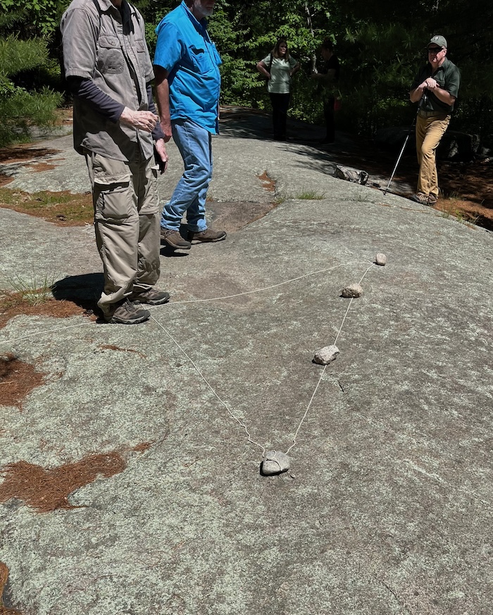
Why are there four boulders? Chuck Drayton thinks there might be an alignment with the winter and summer solstices, spring planting, and fall harvest. Chuck created a model of the alignment with stones and strings.
There’s also a single boulder on the edge of the woods, at the southeast end of the Boulder Row (photo below). I marked it with an S. There may even be an “eastern line” of boulders, subsidiary to the “main line,” and smaller than the main line.
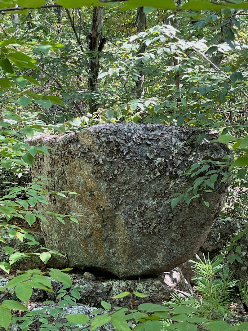
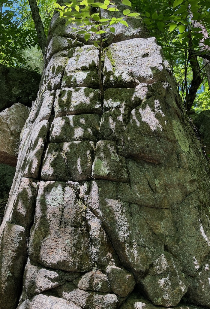
Another highlight of Gilbert Hills is what I call the “Acorn Boulder,” a very large boulder balanced on bedrock so that it points upward. I call it the “Acorn Boulder” because it’s on the Acorn Trail, perhaps 3/4 mile from the park headquarters. I marked its location with an A. It’s not on the stone-structure map, perhaps because there are no “propping stones” under it, so some people might think it’s natural, not man-made. I think the probability that it was made by Native Americans is at least 100 to 1.
“Acorn Boulder”
The “style” of the Acorn Boulder is consistent with other NativeAmerican stones; Native Americans liked to put boulders into the air, they liked to raise boulders from the earth. Nature does the opposite, nature settles old stones in the earth — or perhaps I should say, nature builds up the earth around old stones. If you look under the Acorn Boulder, you’ll notice that it’s almost entirely in the air, it only contacts the earth (the bedrock) at a few small points — a masterpiece of NativeAmerican stonework, made with just one boulder.
One could argue that Western art is based on similar principles. Ballet, for example, is about defying gravity, leaving the earth; the dancer stands on the toes of one foot, or leaps into the air. In death, everything surrenders to gravity, sinks into the earth. Perhaps defying gravity is affirming life.
The route on my map starts at the park headquarters, and you hike toward the northwest. You can also park on High Rock Road (off Route 1), and hike toward the southeast. I put a blue parking icon at this alternate parking-area. If you park here, you’ll be close to High Rock (picture below).
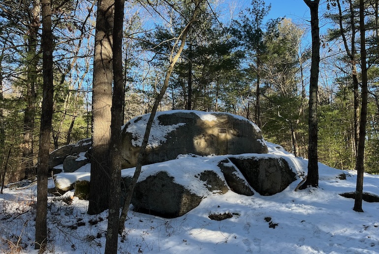
High Rock isn’t very high or large or imposing. It seems to have the “staircase shape” that I found at Redemption Rock, and at the Harvard Common. The staircase shape is created (in my view) by a glacier ripping off chunks of rock from the south side of the outcrop, as the glacier moved south.
If you look closely at the photo of High Rock, you’ll notice a tablet honoring Mead Bradner, who worked on the Warner Trail. The Warner Trail passes High Rock; from High Rock, the Warner Trail goes 13.3 miles north to Sharon, and 20 miles south to Diamond Hill in Rhode Island. It seems that Mead Bradner (or another friend of the Warner Trail) built a lean-to along Warner Trail, about a quarter-mile east of the HighRock parking area; the lean-to is marked on Google Maps as “Trail Hut.”
I put a blue star icon at the location of a small perched boulder (picture below).
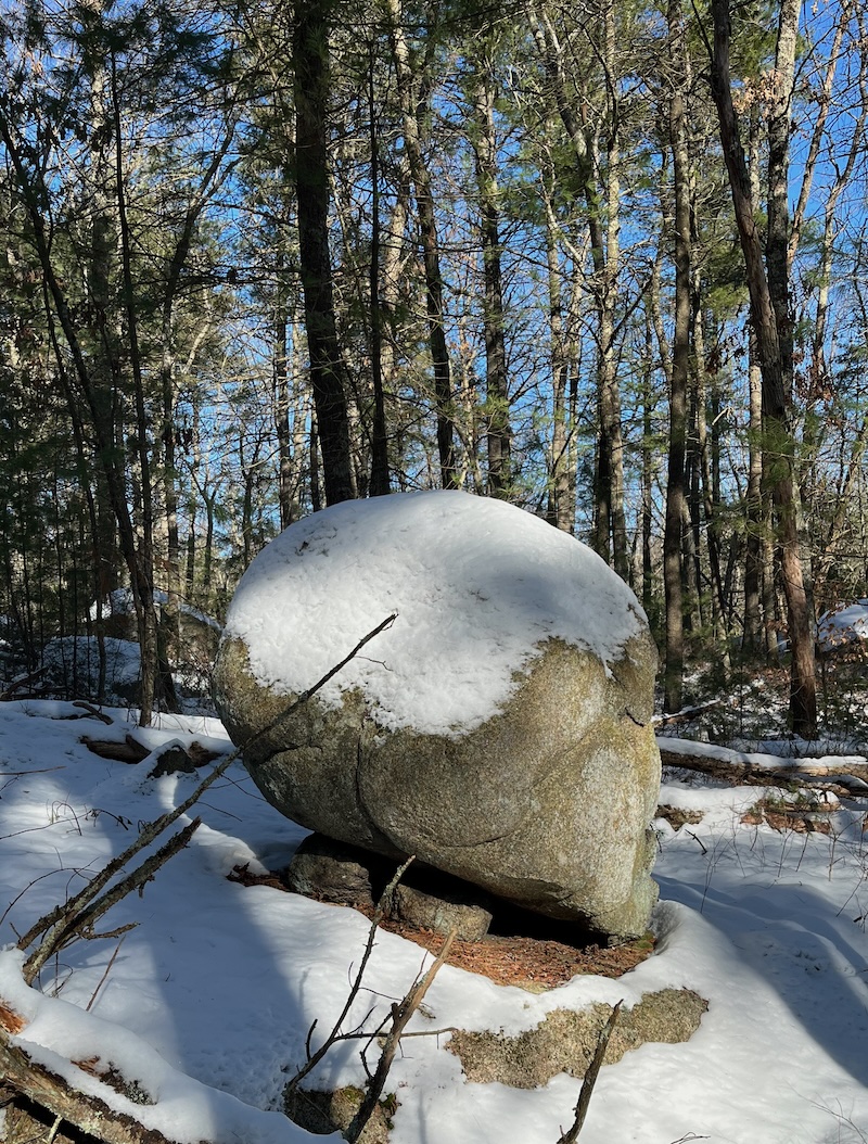
If you walk around the above boulder, you’ll notice another propping stone on the backside. Together these “proppers” raise the boulder almost entirely into the air.
Below is a 4-5 mile route that starts on High Rock Road, and goes south, visiting various stone structures, including the Foxboro Dolmen.
I put a red pin on a strange stone grid (see below).
It’s difficult to say whether this grid/checkerboard is natural or man-made.
I did this walk with NEARA (New England Antiquities Research Association). The leader of the walk, Chuck Drayton, invited us to reach our own conclusion about the grid.
Below is a hill with a square rock, which I circled.
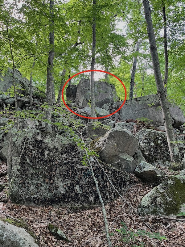
If you walk around the rock from the right, you’ll come to “steps” that take you to the top of the rock, which is a flat, mossy area, large enough for 4-5 people to picnic. To reach the rock, leave the trail at my black pin (map 2), and bushwhack to my brown pin.
Shortly after you pass this square rock, the trail makes a sharp left turn. You’ll walk along a pleasant stone ridge, then reach the Dolmen.